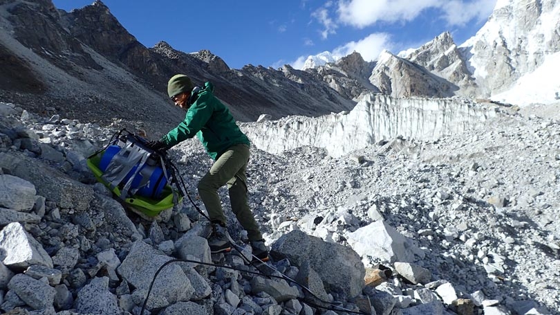
Alexandra Giese taking ground penetrating radar measurements on the Changri Nup glacier in Nepal, 17,500’ above sea level (Photo: A. Giese)
The Dartmouth Graduate Alumni Research Award is funded through the generosity of alumni of Dartmouth graduate programs. Every school year, graduate students can apply for funding of up to $1000 to support their thesis research.
Glaciers covered in layers of rocky debris exist in various mountain ranges worldwide. They are particularly prevalent in High Mountain Asia, which includes the Himalaya, Karakoram, and Hindu Kush. High Mountain Asia is often called the Third Pole for having the largest mass of ice outside Greenland and Antarctica. Unlike the polar ice sheets, High Mountain Asia’s large ice volume coincides geographically with a high population density. The glaciers in the mountains of Asia contribute to rivers that deliver water to 20% of the world’s population.
Given the number of people who depend on Asia’s glaciers for their water, it is imperative to understand debris-covered glaciers and their role in the water cycle. However, political, security, and access issues have presented barriers to scientific exploration and field studies in the Third Pole (or HMA if you like it better) in the past.
Numerical modeling is an important tool that can elucidate some of the processes at play in glaciers, particularly when done in tandem with field and remote studies. Since traditional glacier models do not simulate processes in debris layers, we need a different class of models for glaciers covered in debris. Virtually all existing models for debris-covered glaciers do not treat the spaces between the debris rocks—interstitial spaces—in a physically realistic way. This is an enormously important detail, however, as different materials (air, water, ice) filling these interstitial spaces have different influences on the thermal properties of the debris layer. In other words, it controls the transfer of heat from the debris’ surface and the amount that the glacier underneath melts.
The Interactions between Soil, Biosphere, and Atmosphere (ISBA) land surface model within the SURFace EXternalizeé (SURFEX) platform written and maintained by Météo-France provides a tool for modeling the debris layer of this special subset of glaciers. ISBA was written as a soil model and must be modified to simulate glacier debris. By adapting ISBA for debris in the new model called ISBA-Debris (ISBA-DEB for short), my advisers and I have built a model that not only solves for the temperature and moisture of a debris layer but also computes glacier melt. I have worked with Drs. Patrick Wagnon, Samuel Morin, and Matthieu Lafaysse in Grenoble and Dr. Aaron Boone in Toulouse.
With the help of the Alumni Research Award, I was able to travel to Météo-France (Toulouse, France) in May 2018 to work alongside Dr. Aaron Boone, one of the creators of the original ISBA, for 10 days. Dr. Boone’s collaboration and mentoring advanced my dissertation work beyond what would have been possible without in-person access to his expertise. We introduced an important phenomenon to ISBA-DEB that occurs in glacier debris but not in soils.
Our ISBA-DEB calculates temperatures, water and ice contents, and glacier melt. This makes it the first model, to our knowledge, that can simulate moisture patterns in glacial debris layers that are consistent with field observations. Because the user specifies debris properties and inputs weather data, ISBA-DEB is a widely applicable model that can be applied to any glacier, climate setting, and debris type.
In my doctoral dissertation, I am combining what I learn from ISBA-DEB with field measurements of the debris layer on Changri Nup glacier in Nepal (pictured above). Understanding how water in debris layers affects glacier melt is an important step in estimating future water supplies for the people who live downstream of debris-covered glaciers such as those found at the Third Pole.